Saturday, March 26, 2011

Beaches around Mangalore, India

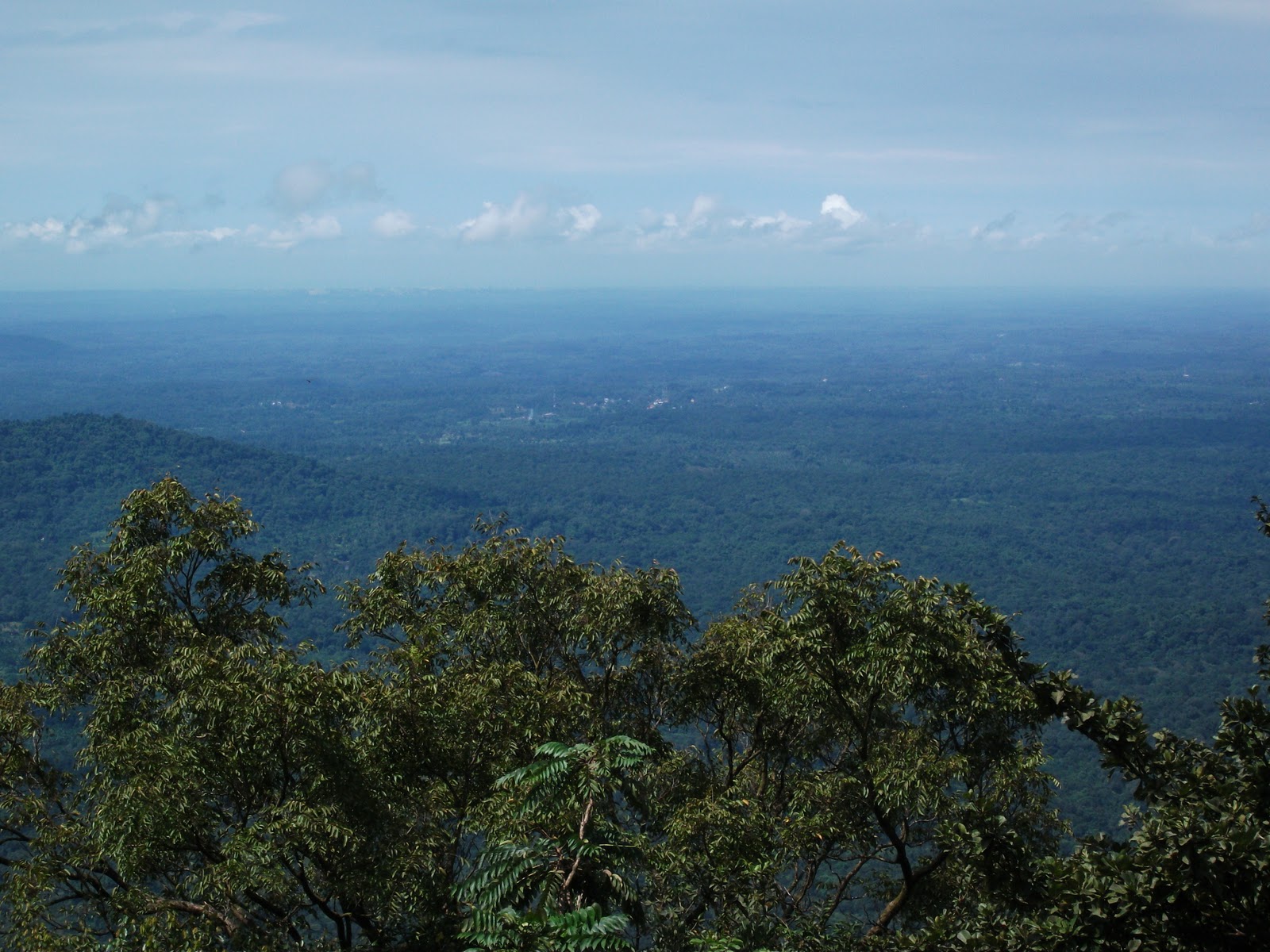
Mangalore is home to many excellent beaches. However, they are not shallow and dangerous to swim unlike the beaches in Goa. The stretch of beaches is spread on the outskirts of the city. There are no beaches touching the city, as two rivers Nethravathi and Shambavi surround Mangalore on three sides and join the Arabian sea. A natural breakwater near Tannirbavi prevents the sea from touching Mangalore.
The beaches are spread from North to South across NH – 17 from Surathkal to Ullal. All these beaches are about one km from the highway and easily accessible. In the north are Sasihithlu, Surathkal, Hosabettu, Panambur & Tannirbavi beaches. To the south are Ullal and Someshwar beaches.
Sasihithlu beach is two kms before NITK Surathkal near Mukka, 22 kms from Mangalore on NH - 17. A small deviation near Halyangadi leads to this spectacular beach. It is a beach meant to enjoy its beauty. The white sands look like a milky way spread across the blue sea. Cool breeze from the sea provides soothing relief. Its quite and noise free here, with hardly any people in its vicinity. Tourists are absent here except for the local fishermen.


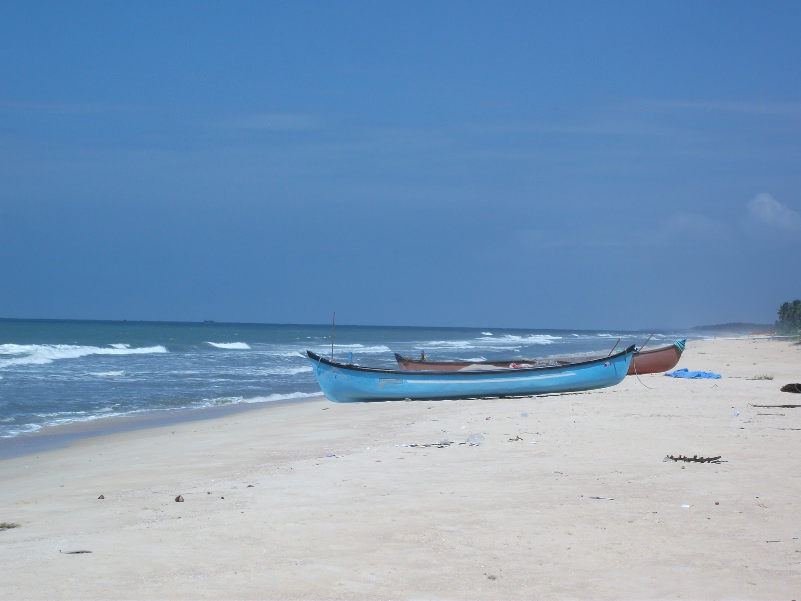
Surathkal Beach is right opposite NITK Surathkal, 20 kms from Mangalore. A left turn from the highway and hundred mts near the temple is the breathtaking beach.


Surathkal beach is beneath a huge granite hill. The blue waters of the sea can be seen from the top of the hill. The road from the top leads to the beach at the bottom. There is a temple of a hindu goddess on the top of the hill. The major attraction of the beach is a red colour light house. The entrance to the top of the light house is open in the evenings. The view of the beach from the light house top is mesmerizing.


Panambur beach is on NH – 17, 10 kms away from Mangalore. This beach is next to the Mangalore port. Panambur is the only developed beach in Mangalore. Water sports, beach activities and eateries can be found in Panambur beach. It has bathing facilities also. Walking on the artificial water breaker made of rocks is fun. This is the most crowded beach in Mangalore.


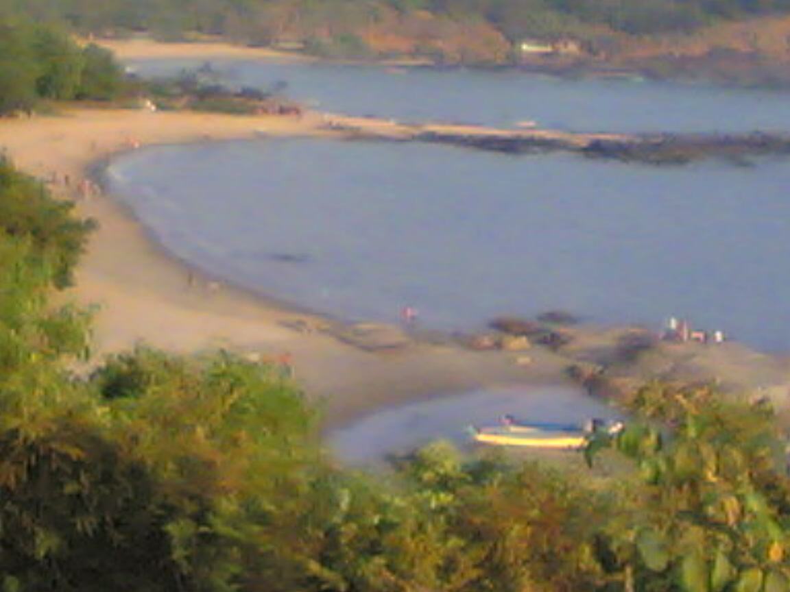
Thannirbavi Beach is the nearest beach in Mangalore. This beach is around 8 kms from the city. A right turn on NH – 17 near KIOCL before Kuloor bridge leads to Thannirbavi beach. A two kms concrete road next to the river Shambavi leads to the beach. Driving on this road is existing and offers a panaromic view of the river joining the Arabian sea. Stop on this stretch for a while to catch the glimpse of the river flowing gently to join the sea.


Thannirbavi beach is spread across a few kms and is accessible at many points. The first stretch is at the guest house. This place is quiet and covered with shade trees and is nice to relax under the hot sun. The next stretch is a few yards away which has good parking facilities. The Den Den ship which sank here in 2007 can be seen here.
Bengre, a fisherman’s village starts from here and is half kms in width and 8 kms long and surrounded by the Arabian sea on the right side and Shambavi river on the left side. The beach is a natural break water and saves Mangalore city from the tidal waves. The road continues until the end of the breakwater to its edge in Bengre village. The land area is less than 500 mts on this stretch. Ferry service is available from Bengre village near Fathima church to Sulthan Bathery in Mangalore. The ferry ride is most enjoyable.


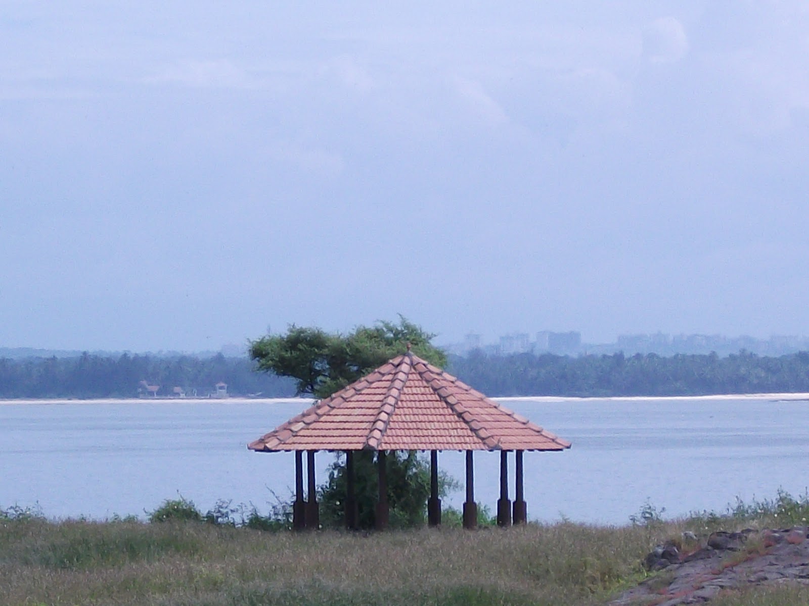
Ullal beach and Someswar beaches are situated on the south of Mangalore. Both these beaches are a few kms away on NH-17, around 10 kms from Mangalore. One has to cross Nethravathi river on Ullal bridge to reach the beaches.
Someshwar beach is the best and most beautiful beach in Mangalore.  The sunset  view in Someshwar beach is unforgettable, a feast for the eyes and a favourite for photo lovers.

Someshwar beach is spread over a few kms and can be accessed at many places. The first point is near MUDA layout after Summer sands resort. This place has shade trees and offers quiet view of the soothing blue waters. An ideal place for picnic lovers.

Thursday, March 24, 2011

St Mary's Island, Udupi, Karnataka

St Mary’s Island is a tiny uninhabited island off Malpe coast in Udupi.  This small island invites nature lovers to explore its beauty. The blue waters and white sands are a mesmerizing sight to watch.


Vasco da Gama landed at St. Mary's Islands in 1948 on his voyage from Portugal to India. It is believed that he fixed a cross on the island and named one of these islands, El Padron de Santa Maria, as a dedication to Mother Mary, before he proceeded to Kozhikode in Kerala. It is from this name that the islands are called as St Mary’s Island.


The major attraction of St Mary’s Island is the Basalt rocks spread across the beach. Continuous waves hitting these basalt rocks since ages has shaped these rocks like standing pillars. Scientific studies indicate that the basalt of the St. Mary’s Islands was formed by volcanic activity, because at that time Madagascar was attached to India.
The islands form one of the four geological monuments in Karnataka state, out of the 26 Geological Monuments of India. The monument is considered an important site for Geo Tourism.
Out of the four islands which form St. Mary’s Islands, the northernmost island has a basaltic rock formation in a hexagonal form, the only one of its type in India. The island covers an area which is about 500 mts in length with a width of 100 mts. It has beautiful coconut trees spread across the island and hence the island is also called Coconut Island. There is no habitation on the islands and tourists can climb the tree, pluck the tender coconuts and drink as much as they can. It is the only place in India, where coconuts are available free.

The uninhibited St. Mary's Island can only be accessible by boat from Malpe harbour. There is regular boat service from Maple harbour to St Mary’s Island, which is 6 kms from the harbour. The boats will sail only if enough passengers are available. There will be plenty of visitors during the weekends. The boats make regular trips to & fro from the harbour and the island. So, tourists have enough time to spend on the island.


However, unfortunately night stay facilities are not available at the island. Visitors have to get back home in the evening. Drinking water and food is also not available in the island. Few vendors sell water, soft drinks, snacks and fish. But, there are no restaurants and toilets.

Swimming can be dangerous in the islands as many visitors have lost their lives here. Guards keep watch here for visitors and do not allow to swim at the rear side of the island. But, there are some points in the island where swimming is allowed.  
A walk around the island across the beach is memorable. Varieties of shells are scattered across the beach. Hugh rocks are spread on the beach where it is pleasant to sit.
The boat ride from Malpe harbour to St Mary’s island is memorable. This 30 minute ride is enjoyable and one will be lucky to see diving dolphins. The boat cutting across the blue waters and the soothing winds add colour to the quiet boat ride.

Wednesday, March 16, 2011

Malpe & Padubidre Beach, Udupi, Karnataka

Beaches near Udupi
 St. Mary’s Island, Malpe, Kapu and Padubidri are popular beaches near Udupi.
Padubidri beach is 25 kms from Udupi on NH-17 on the way to Mangalore. A right turn on NH-17 two kms before Padubidri and a further one km drive leads straight to the beach. There is a resort right on the beach which has comfortable accommodation and dining facilities. This beach is quiet and unexplored. The waters are clean and blue and the sands are without any litter. It is a quiet beach for a getaway and for silent vacation. Not many people visit this place and this makes this beach an ideal location for relaxation.


Malpe Beach is 10 kms from Udupi off NH-17. It is a flat beach and an ideal place for water sports and taking bath. The beach is spread at a wide stretch and excellent for taking a walk. The exotic St Mary’s Island which is a few kms away can be seen from Maple beach.
The famous Paradise isle beach resort and other cozy resorts are located here. On Sundays and holidays local sand sculptors make sand images on the beach. Plenty of water sports are available here for the young. Lot of activities are held here for the adventurous and children. The beach has decent bath facilities and benches to relax. A few coconut trees on the coastline offer soothing shade in the scorching sun for a memorable siesta. Malpe beach has many eat outs offering sea food and coastal delicacies.


Wednesday, March 9, 2011

Agumbe Forest, Shivamogga Dist, Karnataka, India

AGUMBE GHAT
Want a glimpse of Switzerland? Then head for Agumbe for an exotic experience with the untamed spellbinding woods. Its between you and nature at Agumbe.
It’s a trekkers paradise with all the making for a rough and tough trek. You’ll be lucky enough if you can see the sun, such are the virgin forests here.


Barkana Falls


View of Someshwara from top


Agumbe Ghat

Hair pin curve in the ghats. One of the 14 hair pin curves

Sunset view point

WHAT TO SEE: Nestled in the fringe of the western ghats, Agumbe has a lot to offer tourists, especially trekkers. Situated 30 kms from Hebri in Udupi District, the road upward the ghats is 10 kms long, until you reach the highest point.
A narrow but pleasing road from Someshwara village leads you to Agumbe. The road has 14 hair pin bends, a challenge for drivers. Covered with dense woods on either side, the trek brings to mind the setting of a Tarzan movie. With tall trees blocking out the sunlight, there is much to see here. As you move up the ghats, the view of Someshwar village with field, houses and roads from thousands of feet above reminds one of a view from a plane.
You can refresh yourself during the trek with the cold, sweet, fresh water from the streams. Three such enchanting streams beguile and allure you to have a drink. Wild monkeys and birds add to the blissful trek. Agumbe is home to Lion tailed black macaque monkey and king cobra.


                       Boating is available at the check post in Agumbe

               Monsoon trek in Agumbe ghat is fun. The uphill trek is 12 kms long
The sunset point at the end of the trek is a breathtaking sight. A panoramic view of the mountains can be had from the cozy little sunset point. The sun set at Malpe beach can be best seen from here. The sun takes the form of round, oval and other shapes here. 
The sun slipping into the darkness against a background of green mountains is a sight to cherish. The sunset point, located thousands of feet above the sea level, offers a view that can be had in Switzerland.
Away from the sunset point, dances the solemn and sublime water fall. Like a chaste angel, the water fall pours down the huge mountains of the Western ghats.
Don’t forget to carry your binoculars to catch a glimpse of the water falls. Other places worthy to visit in Agumbe is the Barkana and Jogi Gundi water falls. Jogi gundi falls is 5 kms from Agumbe inside the dense forests. Barkana falls can be viewed from the view point 5 kms away from Jogi gundi falls.


                                                     Jogi gundi falls

                                      Barkana Falls


                                     View point at Barkana Falls


HOW TO GET THERE: The best way to get to Agumbe is by bus. Trekkers should get down at Someshwar, located at the foot of the Ghat. Then trek the road up way the ghats which is 10 kms long. There are plenty of buses plying to Shimoga via Agumbe from Mangalore and Udupi. Agumbe can be reached from Shimoga. The distance is 100 kms from Shimoga.


                        Mushroom on plant in agumbe forest
WHERE TO STAY AND EAT: An old traditional guest house near Agumbe circle can refresh you, but check the facilities before checking-in. Malgudi days was shot in this guest house. Do not miss the Malnad cuisine at the restaurants at Agumbe. Make sure you pack foodstuff and water for the trek as its dense forest all round.
BEST TIME TO VISIT: Rains play havoc in Agumbe, the second most rainy place in the world after Cheerapunji. Hence, the most suitable time is November to April when the rains are absent.


           Accha Kanya falls, 20 kms from Tirthahalli near Ambutirtha

Monday, March 7, 2011

OM Beach, Gokarna

OM BEACH, GOKARNA
Gokarna is a perfect place for spiritual tourism. The word ‘OM’ is synonymous with Lord Shiva. Gokarna means Cow's Ear - It is believed that Lord Shiva has emerged from the ear of a cow. Gokarna is known for Atma Linga brought by Ravana and is famous as Dakshin Kashi. It’s a coincidence that the beach in Gokarna is like the shape of the Sanskrit letter `OM’, and is named accordingly.
Gokarna lies in between Kumta and Ankola in Uttar Kannada District. Popular for the Shiva Temple, Gokarna is a holy pilgrimage place for hindus. The Tambraparni Teertha here is considered sacred to perform obsequies of the dead.

Om beach has its own charm and charisma. It is situated on a hilltop, providing a spectacular view of the Arabian sea. No sunset can be best viewed as in Om beach. Even the sunset at Agumbe ghat does not provide the brilliance of the sun set as seen at Om beach.
Om beach is located 8 kms from Gokarna town. The approach road to the beach is breath taking. The road climbs the hills to reach the beach. As one climbs the hills, the sea unfolds its vast beauty. The entire coast is visible in blue which is a visual treat.
The road reaches a dead end, from where steps go down to Om beach. One can clearly see the shape of the beach just like `OM’ Sanskrit letter from the top. The beach is around 100 mts down from the hilltop. The steps in the rocky surface leads to the sublime beach.
Om beach is about one km in length. It is sandwiched between two huge hills. Rocks are found in the beach side which adds beauty to the beach. The sands in Om beach are soothing. Foreign tourists outnumber Indian tourists in Om beach. It is a popular destination for hippies worldwide.
Boat service is available from Om beach to Kudle beach & Half moon beach. Other water sports are also available. The advantage of Om beach is that it is not crowded like the beaches in Goa. It is very clean and has decent crowd. Hawkers and vendors are almost absent.
Many shanty restaurants dot the beach side offering local and continental dishes. The food served is average, while liquor is of good quality. There are not many lodges here. A few hotels offer basic accommodation, while a couple of them are luxurious.
Kudle Beach: A small trek of 15 minutes from the hill top of Om beach is Kudle beach. A kilometer of walk south of Gokarna Beach, Kudle Beach is surrounded by hills on three sides and sea on the fourth.
The trek is enjoyable as it is inside a forest. Kudle beach is cut from the outside world as there is no road connectivity. One has to trek to reach Kudle beach. This is a flat beach and beautiful than any other beach. Many restaurants dot Kudle beach side.

Half Moon Beach and Paradise Beach:  These two beaches are further south by 15 minutes from Om Beach, and not very far from each other. A trek from the other end of Om beach leads to Half moon beach. The trek starts from the left side of Om beach. The narrow path climbs the hill and cuts across the dense jungle to reach half moon beach. The trek is about an hour and tiring also. The path is covered with bushes and difficult to trek. Half moon beach is cut off from the outer world and does not have road connectivity and electricity too. An ideal place for nature lovers. Both beaches are much isolated, as there is no habitation in the vicinity for a couple of kilometers. The isolation makes them more appealing and worth a visit.

Gokarna Beach:   This beach is in Gokarna town next to the temple. Lot of devotees take a dip in the sea here, which is a religious custom. This is the longest of all the beaches, almost 7 km of straight stretch of sand.
Gokarna is a town of contrasts as it is a temple town and also a holiday destination. The place is full of palm and coconut trees. It is an attraction town with two main streets with shops and traditional tile roofed brick houses. The Car Street, which runs through the heart of the town is a typical Pilgrim center, flanked by small business, Puja items, souvenirs and food stuff. The maze of narrow lanes and alleys are reminders of tradition, which continues even today. Brahmin priests go about busily with their religious duties. A walk through the main street would not take more than twenty minutes.
How to reach: 'Gokarna Road Station', a railway station on the Konkan Railway line, is approximately 6 kms from Gokarna town. Gokarna is connected by NH–17 and is situated 240 kms from Mangalore, 453 kms from Bangalore and 59 kms from Karwar. The nearest airport is Mangalore.